
Andrea Helmuth
Azores Trail Run (English Version) 2014
Born to be wild
We will have sunny days on Friday and Saturday, even midsummer weather on Sunday! Responsible for these conditions is the anticyclone „Guido“ moving from the Azores towards Europe reaching Germany on the weekend. The decision is final: I want to be there, in this meteorological laboratory, where the nice weather for Europe is born, and where ships on the high seas suffer extreme conditions at the same time. I want to be at this very spot, where the forces of nature and volcanoes are always omnipresent, and sometimes violent.
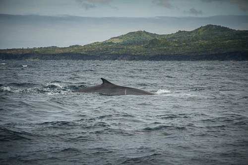
Using Google Earth I imagine myself zooming down from space. The closer I get back to earth the more do the edge contrasts increase. At the very end, I find myself hidden, although I am wearing a bright life jacket, in the vastness of the bluish black North Atlantic between Europe and Africa. The sea is deep. Playful dolphins, whales passing through, while fifteen other life jackets surround me; and more than five hundred fish species cavorting beneath our bright red rubber boat.
The special underwater topography was formed by volcanic activity, leading to an abundance of food for the marine creatures. Up until 1982, sperm whales were hunt by Azorean “Whalers”, as Herman Melville portrays in “Moby Dick”. It is not hard to imagine those times. The whalers of Faial and Pico were said to be honest, modest and brave. The grandsons of those men, who suffered the struggles against the unleashed forces of nature, cold and storms, call themselves “whale watcher”, and today we are on a bloodless photo hunt together. The possibility to witness this immensity of marine mammals is unequalled worldwide.
Circumnavigator’s Island
Albert Einstein knew that “the most beautiful thing we can experience is the mysterious”; and he was right. To find a special spot on this planet, that is not associated with a picture everyone immediately has in his or her mind, is not as easy as it used to be. On the quest to find one of the last true paradises and not another island destination of a glossy magazine, the American journal “National Geographic Traveler” praised and honored the Archipelago second most beautiful group of islands in the world. Faial Island belongs to Portugal and has been spared from mass tourism until today. It remains a heaven for nature enthusiasts and individualists; and the whale watching serves as a meditative plunge into a different world.
The most western Trail of Europe
Despite the slight breeze on this early morning, beads of sweat remain on Mário Leal’s tanned forehead. As an Azorean local and experienced trail runner himself, he never would have imagined his first edition of this event to attract so many runners. Mário had posted the event on Facebook in February, and within three months almost ten thousand user hit the “Like”-button.
Already in 2011, 39-year-old Màrio envisioned an Ultra-Trail on this island. Secluded plains, the welcoming natives, and the topography of Faial provide an ideal setting for a top-class trail running event: whether distance (48K or 21K), level of difficulty, extreme or recreational runner. This new event and the attending stars of the Ultra Trail Running scene attract all sorts of media representatives and everyone wants and gets an interview.
Carlos Sá (winner of Badwater and UTMB), Telmo Veloso, Armando Teixeira (Portugal), Mirko Righele (Italy), Sebastien Nain (France) and Daniel Calleja (Spain) will start. Anna Frost is ready to start, too. The globetrotter is known for being a specialist in mountain running, and is signed on Salomon. I met her first at the 4Trails. She is living her passion – running and traveling.
Massive elemental forces once shaped the Archipelago. The track layout leads transversely from coast to coast through 450 million years old territory, over hoary transport routes up to Cabeço Gordo, the island’s highest peak with 1043 meters above sea level. In addition, it circles around the caldera and leads up to the youngest Portuguese piece of land, formed just 57 years ago, the top of the extinct volcano Capelinhos. Faial is the fifth-largest island of the nine Azores and is located in the center of the Archipelago. Its closest neighbor is the island Pico, which is only 9 kilometers away and whose eponymous mountain appears close enough to touch.
The lull before the storm
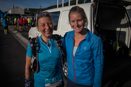
Sleepily I dig around my backpack and look out the window of the fully laden coach that takes us from the race hotel to the start in the small village Ribeirinha. The sun is shining warm and the sky is cloudless blue. Only here and there, immigrant (home) dreams are for sale: “a venda” with a phone number below – I do not note it down.
The mood is calm and relaxed among the group of outdoor enthusiasts. My backpack is heavy, but despite the announced warm weather and the numerous aid stations along the course, I stuffed it with a rain jacket, water, energy bars and gels, and my cell phone in case of emergency. Is this the well-known calm before the storm? Adventurous visions of an extraordinary run strengthen my anticipation – and only Mário knows what will await us.
Run on the Volcano
It is 9 am as we head off, and I am immediately carried away by nature’s beauty. It was in the fall of 1957, when several earthquakes hit Faial; the islands east affected particularly hard. In 1998, the residents of the islands east had been surprised at night once more by one of the strongest quakes with a magnitude of 5.8 on the Richter scale. Eight people died, thousands were injured and lost their homes within minutes. The damages are still visible today.
The mild temperatures form small Stratocumulus clouds above us and draperies of mist hide only Pico in 2.351 meters above sea level. The route leads us on a small paved road towards the Faial National Park, which was recently honored “Destination of Excellence” (EDEN) by the European Union.
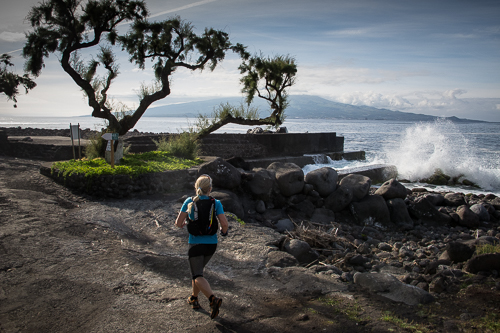
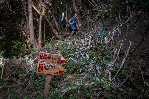
Along the way, we are passing dark lava-stone houses as the sea waves break against the rock faces with a huge impact. We leave the coastal path and climb via old connecting trails between villages and over soil-cut steps. We continue our ascent: over buried roads, where once donkey and ox cart transported goods between the villages, today marked with warning tape knotted around bamboo sticks.
Rua dos Emigrantes
I meet a couple; apparently in love. They are holding hands once and again; or maybe he is just pulling her. He, so he tells me, originates from Porto. She grew up on the island. Many have left the island by now. Each and one of them has their own story to tell. It is said that more cattle than men is living on Faial today. Thus, on each Azorean island exists a “Rua dos Emigrantes”: an Emigrant Street. The last big wave of emigration took place between 1957/58 due to the massive igneous activity that was lasting for more than thirteen months. Of the 30,000 residents, more than 15,000 left the island; most of them immigrating to the not far-off US.
The trail leads over a meadow and almost straight towards the skeleton of the Ponta do Ribeirinha, a once 20 meters high lighthouse, destroyed in 1998 by another earthquake. Many large and countless smaller cracks run through the remaining masonry. Signs warn of the danger of collapse.
Island Cross
The path gets narrower. Only one small trail is cut free from trees and bushes, and it seems like God himself ran riot with an axe. A farmer who helped clearing the historic paths that stretch for kilometers is standing on the wayside. He is smiling and happy to be photographed. In the background, the Pico starts smiling, too. What a spectacular postcard motif.
Today the weather does not betray us. The bad weather is hanging around somewhere in Europe, but not often here. “If the weather gets bad here”, the friendly cab driver explains immediately after my arrival, “The Azores High drifts to Central Europe”. Just like that.
The Azorean people talk about three different seasons – and all of them can appear in one day. It happens to be semitropical and mild, and in the next moment it is stormy and rainy. Only snow does not fall here. All in all, the perfect natural irrigation system for the deep green of the Archipelago.
I am prepared and expecting the worst, especially because I know that I will be outdoor for more than seven hours. Underestimating the changing weather conditions can lead to unexpected effects, but I did not imagine the subtropical heat even under the deep shade of the trees.
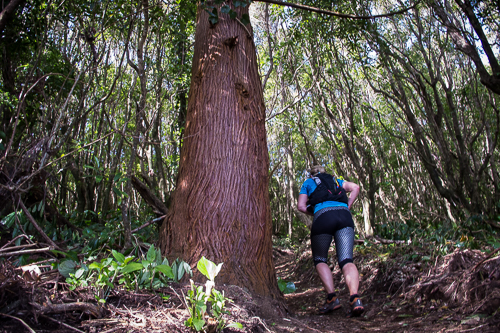
However, I carry on running through a forest with eucalyptus trees and only one sole photographer is hanging from a tree equipped to take the best shots of the approaching runners. To the left and the right of the trail are nearly endless fern woods and high reed plants. “The clearest way into the Universe”, as John Muir was aware, “is through a forest wilderness”. The Archipelago is a marvelous botanical garden with more than a 900 different fern and flowering plants, 59 of them growing only here.
Even Mark Twain has travelled these roads; on a donkey’s back without stirrups and in a saddle, he described to be as large as a dining room table. Happy to be on foot, I am moving through the low-profile section quickly and where the paths narrow once again it gets even more beautiful with every step.
Walk on the wild side
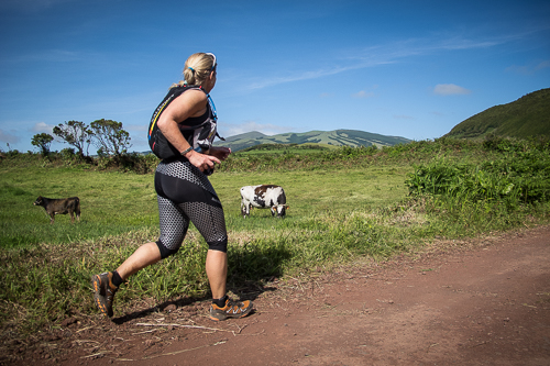
We reach the desolate interior of the island with its strikingly green landscape enclosed by vineyards and fields, cows grazing on succulent pastures and palm trees scattered over the area. From here, the trail leads to almost untouched nature: Tense cedar forests, meter-high fern, bamboo and laurel trees plus the ubiquitous chirping of birds.
Leaving the thicket behind and admiring the abundant white calla flowers along the trail, we pass gigantic hydrangea bushes, which have not yet begun to bloom, and continue on a small path towards the volcano and my personal stage goal.
The lush green slopes are gradually rising up to the caldera in the center of the island. I gaze over the meadows, small farming estates and low stonewalls built from black lava rock. I enjoy the pure splendors and the soothing serenity of nature wholeheartedly.
After the first 10K, I reach the first aid station and enjoy the flavor of the juicy-sweet oranges and the salty nuts. Both altitude and incline of this majestical volcano, which gently ascents the blue waters of the Atlantic Ocean are difficult to guess until one takes the first step and starts climbing to the top. Happy cows graze peacefully on lush grasslands knowing neither cowbells nor stables. The salty light yellow soft cheese we found on our breakfast buffet this morning was made from the milk of these cows.
The road then climbs up and provides a breathtaking view over the ocean, the sky, and the neighboring island Pico, finally dropping all of his (cloudy) covers. Even the long stretched island São Jorge appears faintly on the horizon. From far away, I recognize the caldera of the Cabeço Gordo with a red-white antenna at its summit.
Island transgression
It is noon. I can see it in the sky and feel it in my tummy. We could have reached the parking lot at the caldera more easily, yet less adventurous. Only a few cars are parked here, and only two hiker cheer on us. I am not sure, if they even know what we are doing here today.
The wooden stairs make the ascent only easier up to a certain point. The wooden path gets significantly narrower, the higher we climb until a scaffolding of branches and gnarled roots is all what is left of it. We gain altitude quite fast and it gets windier and cooler. I cannot imagine what running this path under bad weather conditions must feel like. I revel in the view and the amazing natural spectacle, which exceeds my expectations
Infinitely mesmerized, I am looking into the crater. Clouds covering up the mossy green crater rim, softening the air and the contrasts around me. Volcanic forces once shaped this mouth of hell, its interior swampy and studded with moss. The former Crater Lake seeped away through fissures after the Capelinhos eruption in 1957/58.
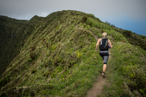
I was looking forward to this part of the trail for hours. Finally, we are on this 7-kilometer stretch around the rim of Cabeço Gordo (meaning “Fat Head”). Guidebooks warn hikers to do the circumnavigation during poor weather. The trail is only two-feet wide with the waves washing up against the coastline on the right side and the steep depths of the caldera on the left side. The view is astounding me even though we are just about 900 meters above sea level. The cedars, juniper and fern between this spectacular scenery create a surreal picture of isolation and silence.
However, we still have not reached the caldera’s peak. The elevation profile of the course did not reveal its true character and although it was said to be a trail of “higher level of difficulty” the race requires quite some stamina in order to make it through the whole distance.
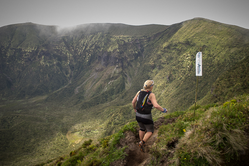
As I look up at Pico, I realize that he has changed his cloudy dress and that he is now wearing a scarf of cirrus clouds. We reach the peak utterly simple. The next kilometers are tedious and time-consuming, and descending over randomly scattered tufts of grass becomes a torture. I would like to know the pro’s tricks to actually race through this demanding terrain. I have to stop running and start climbing; my hands searching for stability grasping at every stone or dense shrubs, and I am beyond thankful that no poisonous snakes or other dangerous animals are said to live on this island.
Take a deep breath! Keep on running! The trail continues in serpentine leading trough sap green forest, I have never seen before. The rust-colored gravel creaks underneath our feet.
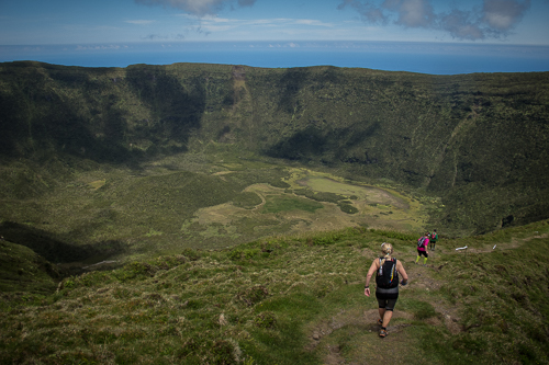
Azores or Amazon
The trail winds through a narrow forest aisle in the Faial National Park and along the Leyada for miles. The Layada’s of the caldera used to be part of a complex water collecting system, which fed a hydroelectric power plant in Varadouro. In 1998, an earthquake devastated most parts of the Levada, which was more than 10K-long back then. The water path was reconstructed and today I can jump over it or climb over the small walls to get to the other side. Considering the hours of running and my „tired“ bones, balancing along the water path is neither easy nor does it look elegant. Little by little, it gets easier and I take my steps with more confidence. Regardless of my aching bones, I do enjoy hopping over the stones. Suddenly the weather gets muggy again and the path leads over a wooden bridge. Would this bridge be a suspension bridge, I would be sure to run in the Amazon forest.
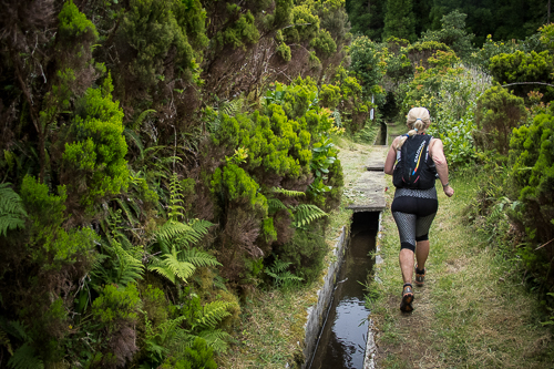
After crossing over the bridge, we enter another forest and it feels like running through a jungle. It is all downhill, and the incline becomes steeper and steeper with every step. In addition, the forest steams with damp, mist rising, the soil becomes soggy and wet. As muddy water flows down the trail my feet lose their grip, I slip and slide with the camera in my hand.
Meanwhile the paths for the ultra-trail and the „10 Volcanoes Trail“ follow the same route. The path is continuous descending. I can only hope that I am running fast enough for the wind to dry the camera. Passing the ancient women’s washhouse, the „Casa das Lavadeiras“, I vainly wish for a cleansing since this place is out of water for ages.
The power of nature
Land in sight! I allow myself to stop and appreciate the impressive view to the far: The volcanic cones look like the backbone of an emerald-colored dinosaur. At its very end, at his head as it were, one can spot the peninsula Ponta dos Capelinhos with its bizarre coastline.
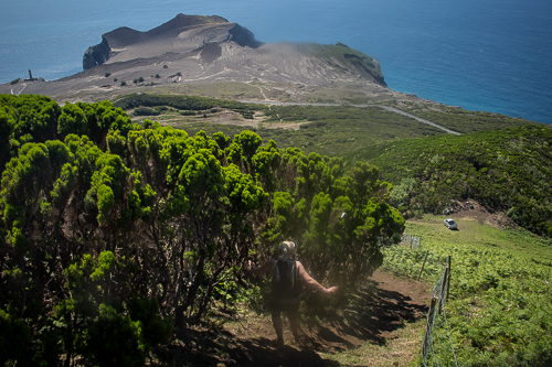
Apparently, the finish line is within sight and sound although it is still more than four kilometers away. That is less than 30 minutes, I think to myself, and regret that thought immediately. The waist-high steps are steep and fern caresses my maltreated legs. Every breath of air tastes like sweat. I try not to lose grip of the lean roots and follow the narrow paths towards the coast.
Deep black volcanic ash meets deep blue sea
Then everything happens very quickly: The scenery instantly turns from a mysterious natural spectacle into a landscape movie – and I wish everything to happen in slow motion. The gravel beneath my feet resembles a desert made of slag and ballast, slowly fading into a moonscape backdrop with ashes and dust in the weary afternoon sun.
Picture this: not too long ago, in 1957, the Atlantic was boiling this explosive brew while white clouds of vapor rose and the ocean started simmering. More than 30 million tons of ash and lava was falling down as the Capelinhos volcano erupted. Those forces have formed the entire Archipelago into its present shape. The people were evacuated but their houses and fields are lost forever. The lighthouse, which was built in 1902, used to be the biggest Portuguese lighthouse back then. Today it stands far away from the coast poking out of the black sand. A few bushes grow in this brown-black ash soil and it is said that it will only take 100-200 years until the soil is completely recovered and green again. The award-winning underground museum „Centro de Interpretação do Vulcão dos Capelinhos“ describes and explains the dramatic events of the volcanic outburst.
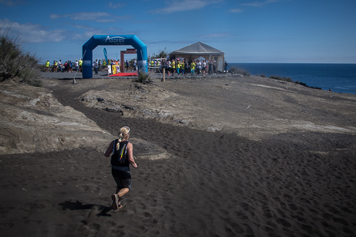
I float over hundreds of meters of deeply buried life. Fine dust of ash warmed by the sun is flowing over my shoes, intruding them like black powdered sugar. I will remember this feeling and once-in-a-lifetime moment, even when I am back home and finding dashes of this dust in my shoes. It does not feel like I am running anymore. I float, powered by my emotions. It is spectacular – I have never experienced such a finish ever before. It is so beautiful that I could cry.
Moving
I dip my feet into the cold and foamy waters of the Atlantic Ocean. We have practically reached rock bottom. Geographically, not mentally. I indulge in reminiscences of the last kilometers up to the finish line: They have been victorious – in the certainty that this is the beginning of something new.
Volunteer and Award ceremony
With vast excitement not only the pros but also everyone else is looking forward to the analysis of our finish times. The tension increases: Anna Frost wins and justifies her role as female favorite. Today, volunteers and runners celebrate together, in a festively set venue, drinking local wine, listening to folk music and eating from an abundant buffet. Everything is perfect.
Wanderlust
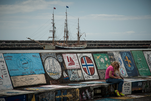
My memory card holds 1926(!) pictures – taken over the last few days. This was a photo shooting exactly after my fancy. Most of the visitors came only for the new trail-race, but what I experienced on this island was so much more than just a race. I have one hour left until I have to leave again. I feel the urge to visit the port of Horta one more time. I see seagulls sliding with the wind and a white catamaran sailing away on the Atlantic Ocean and maybe towards the American continent. The sea is calm as the ship exits the port and vanishes into the horizon.
Résumé: It is still possible to find a new trail-paradise in the ocean of new releases. What is called the „Grand Raid“ or the „Diagonal of the crazy“ on the French island La Réunion is similar to the „Diagonal of the gourmets“ on the island Faial of the Azores. The 48km ultra-trail track lets you experience the island’s creation from the east to the west coast, including geology and history, far away from mass tourism and not suitable for high-life- or pampered all-inclusive tourists. Those who expect a vacation full of sea, beach and warmth will be disappointed. However, what you get is a never-to-be-forgotten encounter with nature, presented as a perfectly staged spectacle including a diverse supporting program. The only unknown factor will always be the weather.
Homepage and registration: http://www.azorestrailrun.com

